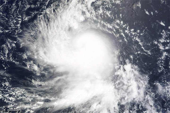
Tropical Storm Danielle formed as a tropical depression over the Atlantic Ocean on August 22, 2010. By the following day, Danielle had strengthened to a tropical Storm, and had the potential to become a hurricane by evening, the U.S. National Hurricane Center (NHC) reported.
The Moderate Resolution Imaging Spectroradiometer (MODIS) on NASA’s Terra satellite captured this natural-color image of Tropical Storm Danielle at 9:15 a.m. AST (13:15 UTC) on August 23. Danielle boasts the apostrophe shape typical of tropical storms, although it lacks a distinct eye.
At 11:00 a.m. AST on August 23, 2010, the NHC reported that Danielle had maximum sustained winds of 65 miles (100 kilometers) per hour, and was expected to strengthen further over the next 48 hours. Danielle 1,025 miles (1,650 kilometers) west of Cape Verde.
La tormenta tropical Danielle se formó como depresión tropical en el Océano Atlántico el 22 de agosto de 2010. Al día siguiente, Danielle se había fortalecido como tormenta tropical y tenía el potencial de convertirse en un huracán por la noche, según reportó el Centro Nacional de Huracanes (NHC) de EEUU.
El espectroradiómetro de resolución moderada (MODIS) en el satélite Terra de la NASA capturó esta imagen en color de la tormenta tropical Danielle a las 9:15 am AST (13:15 UTC) el 23 de agosto. Danielle cuenta con la forma típica de apóstrofe de las tormentas tropicales, aunque carece de un ojo diferenciado.
A las 11:00 am AST del 23 de agosto de 2010, el CNH informó que Danielle tenía vientos máximos sostenidos de 65 millas (100 kilómetros) por hora y se espera que se fortalezca aún más en las próximas 48 horas. Danielle estaba a 1.025 millas (1.650 kilómetros) al oeste de Cabo Verde.
References
National Hurricane Center. (2010, August 23). Tropical Storm Danielle Advisory Archive. Accessed August 23, 2010.
Unisys. (2010, August 23). Danielle Tracking Information. Accessed August 23, 2010.
NASA image courtesy MODIS Rapid Response Team at NASA GSFC. Caption by Michon Scott.
Instrument: Terra - MODIS


.gif)


